
- Polytech
- BATir - Building, Architecture & Town Planning
- News
-
Share this page
Public PhD defence of Joan Botey on "Exploring the potential of satellite InSAR in geological engineering: new opportunities in land monitoring and hydrogeological characterisation"
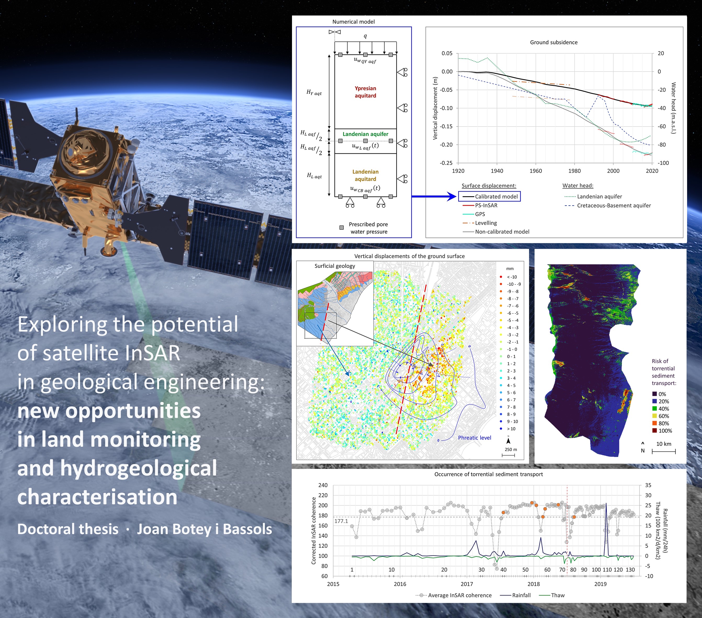
Joan BOTEY i BASSOLS’s public defence will explore novel contributions of InSAR in Geological Engineering, more specifically, in land monitoring and the hydrogeological characterisation of the ground, including both qualitative and quantitative approaches at both regional and local scales.
Author
Joan Botey i Bassols
Short abstract
Interferometry with Synthetic Aperture Radar (InSAR) is a remote sensing technique to measure displacements of the observed surface, either the ground or any structure on it. Although the systematic acquisition of SAR data from satellites started in the 1990s, InSAR is a technique still in development that offers new opportunities as both SAR satellite constellations and data processing improve. Thus, Joan BOTEY i BASSOLS’s public defence will explore novel contributions of InSAR in Geological Engineering, more specifically, in land monitoring and the hydrogeological characterisation of the ground, including both qualitative and quantitative approaches at both regional and local scales.
Supervisors
Enric Vàzquez Suñé (IDAEA-CSIC), Pierre Gerard (ULB), Michele Crosetto (CTTC)
Academic tutor UPC
Nieves Lantada Zarzosa
Doctoral programme UPC
Civil Engineering (Enginyeria Civil)
Doctoral programme ULB
Engineering and Technology (Sciences de l'Ingénieur et Technologie)
11:00 a.m. (GMT+1)